Geohazard & Environmental Assessment
Geohazard and Environmental Assessment embodies a crucial exploration into understanding the dynamic interactions between the Earth’s natural processes and human activity. This discipline delves into the identification, analysis, and mitigation of geohazards such as landslides, earthquakes, floods, and environmental risks arising from industrial practices.
At GEOINTEL, we recognize Geohazard and Environmental Assessment as a pivotal means to safeguard communities and ecosystems. Through advanced scientific methodologies and comprehensive risk assessments, we aim to evaluate potential hazards, assess their impact on the environment, and develop strategies to minimize risks. Our commitment lies in fostering resilient infrastructures, preserving natural habitats, and promoting sustainable development practices.
It’s more than a study; it’s a proactive approach towards harmonizing human progress with environmental conservation, ensuring a safer and healthier world for generations to come.
Core Activities
Defining Our Expertise
Geohazard and Environmental Assessment play a critical role in the oil and gas industry, encompassing meticulous risk evaluation through precise data collection and comprehensive analysis. Field surveys and integrated data synthesis are pivotal in identifying and understanding potential geohazards, such as landslides, seismic activities, and environmental risks associated with drilling and extraction operations. Additionally, we assess the sustainability and impact of traditional energy sources, ensuring responsible exploration and extraction practices.
This comprehensive framework aligns with our commitment to eco-conscious practices within the oil and gas sector, facilitating informed decision-making for sustainable resource management. By optimising assessment strategies and employing advanced technologies, we prioritise the safety of operations, environmental conservation, and responsible resource extraction. Geohazard and Environmental Assessments serve as vital tools in promoting a balanced approach that harmonises oil and gas exploration with environmental preservation and sustainable practices.
Risk Identification and Evaluation
This involves meticulous field surveys, data collection, and analysis to identify potential geohazards, such as landslides, seismic activities, and environmental risks linked to oil and gas operations. Assessing these risks is crucial for understanding their impact on the environment and infrastructure.
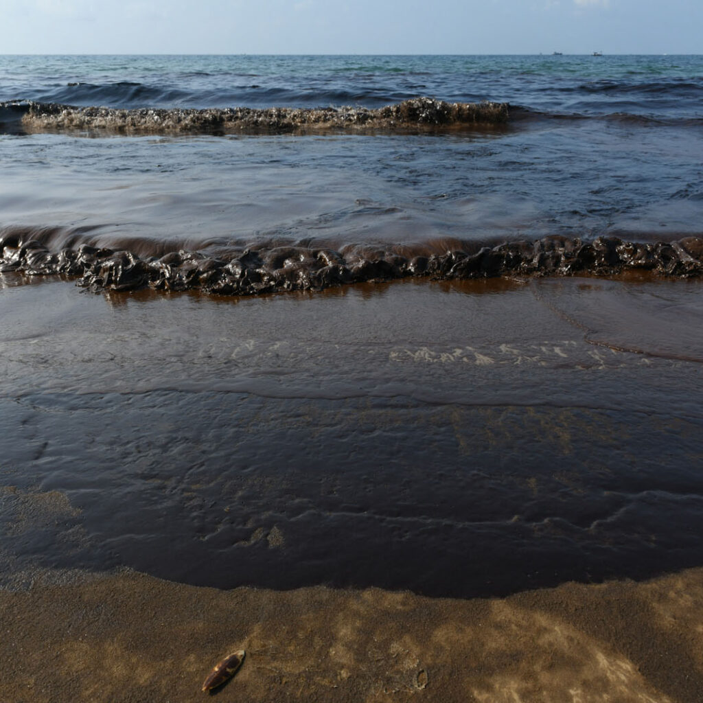
Environmental Impact Assessment (EIA)
Conducting thorough environmental impact assessments is essential to evaluate the potential effects of oil and gas exploration and extraction on ecosystems, water sources, soil quality, and surrounding communities through geochemical analysis.
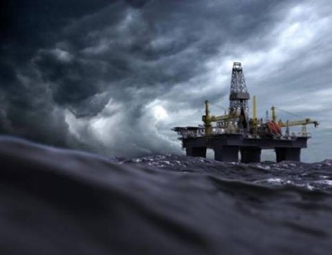
Metocean Study and Analysis
Assessments conducted for offshore facilities to analyse meteorological and oceanographic conditions in a specific environment to understand the environmental factors that could affect offshore operations, including drilling, production, and facility design.
Key Processes
Safeguarding the Future
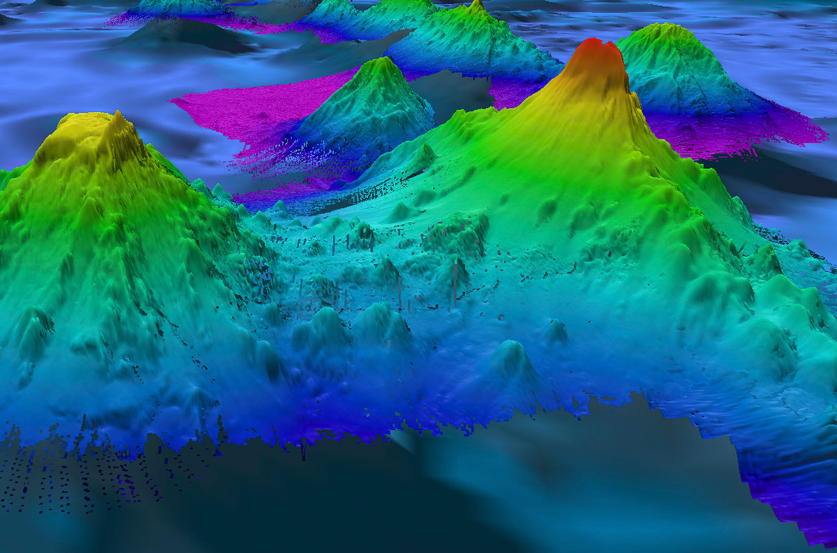
Data Acquisition and Analysis
This process involves using various remote sensing methods and aerial surveys to collect crucial data on geological features, hazards, and environmental shifts. This encompasses utilising satellite imagery from platforms such as Landsat and Sentinel for comprehensive assessments of ocean, land, geology, and environmental changes. Aerial surveys, utilizing LiDAR technology and specialised sensors on drones, ships provide high-resolution imagery and precise terrain mapping vital for hazard identification and environmental monitoring. Complementing these methods, GIS software like ArcGIS processes spatial data, aiding in visualizing and interpreting geological and environmental information. The integration of these technology tools enables precise data collection and analysis, forming a crucial foundation for informed decision-making with the objective of creating sustainable energy exploration in the industry.
Field Survey and Sampling Analysis
This process involve on-site evaluations and precise sample collection techniques to assess potential hazards and understand seabed characteristics. Field surveys encompass physical inspections and data collection in offshore areas prone to geohazards such as landslides, subsidence, or underwater seismic activities. This includes employing specialized equipment like remotely operated vehicles (ROVs) or autonomous underwater vehicles (AUVs) equipped with sensors to gather data on seabed topography, sediment composition, and structural features. Advanced technologies like Gas Chromatography-Mass Spectrometry (GC-MS), High-Resolution Seismic Profiling (HRSP), and Multibeam Echo Sounders aid in analyzing collected samples to detect hydrocarbon content, assess sediment properties, and identify potential geohazards on the seabed.
Reservoir Evaluation and Modelling
The process involves synthesising geological and geophysical data to construct detailed subsurface models, predict reservoir behaviour, and simulate extraction scenarios. It starts by integrating seismic surveys, well logs, core samples, and geological maps to understand rock formations, fluid properties, and hydrocarbon reservoirs underground. Interpretation tools like Kingdom and Hampson-Russell aid in visualising seismic data, identifying structures, and locating potential reservoirs. Specialized software tools are used for 3D reservoir modelling, allowing visualisation and analysis of reservoir traits, fluid flow patterns, and performance. These tools simulate fluid movement within the reservoir, predict production outcomes, estimate reserves, and optimise extraction plans. These advanced technologies are integral for informed decision-making in oil and gas reservoir management.
Embark on your journey today with GEOINTEL
Let's revolutionise exploration together – discover, analyse, and innovate for a sustainable future!